
60 years has made a big difference in the urban form of American cities. This visual tool is a way to review the scope of these changes. In many cases, the most notable changes are a legacy of the urban renewal programs and planning of the mid-century period. This often meant the clearance of large swaths of developed urban land, especially downtown districts and Black, immigrant, or low-income areas and replacement with freeways, institutions, and mega-projects. For additional context and readings, visit the project homepage.
We put together these sliders to show how cities have changed over half a century.
How to Use
Click and drag the slider as shown in the image below to compare images.
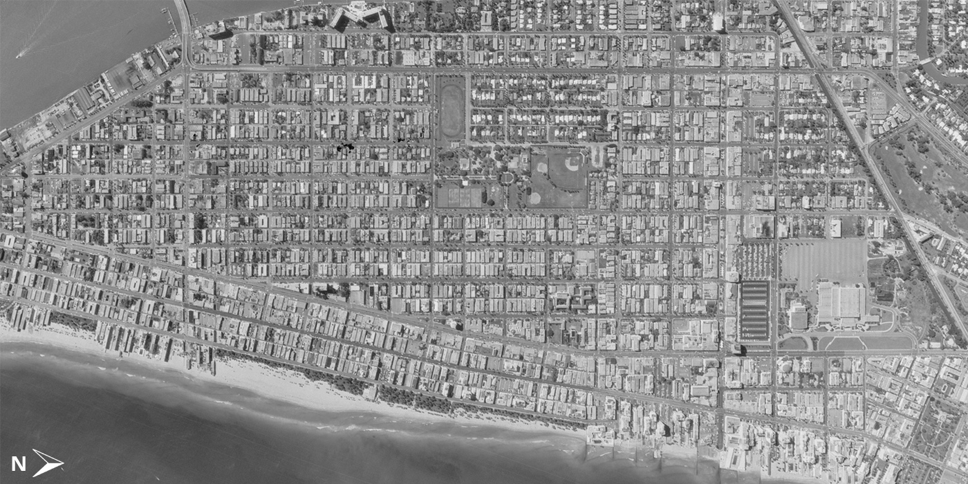
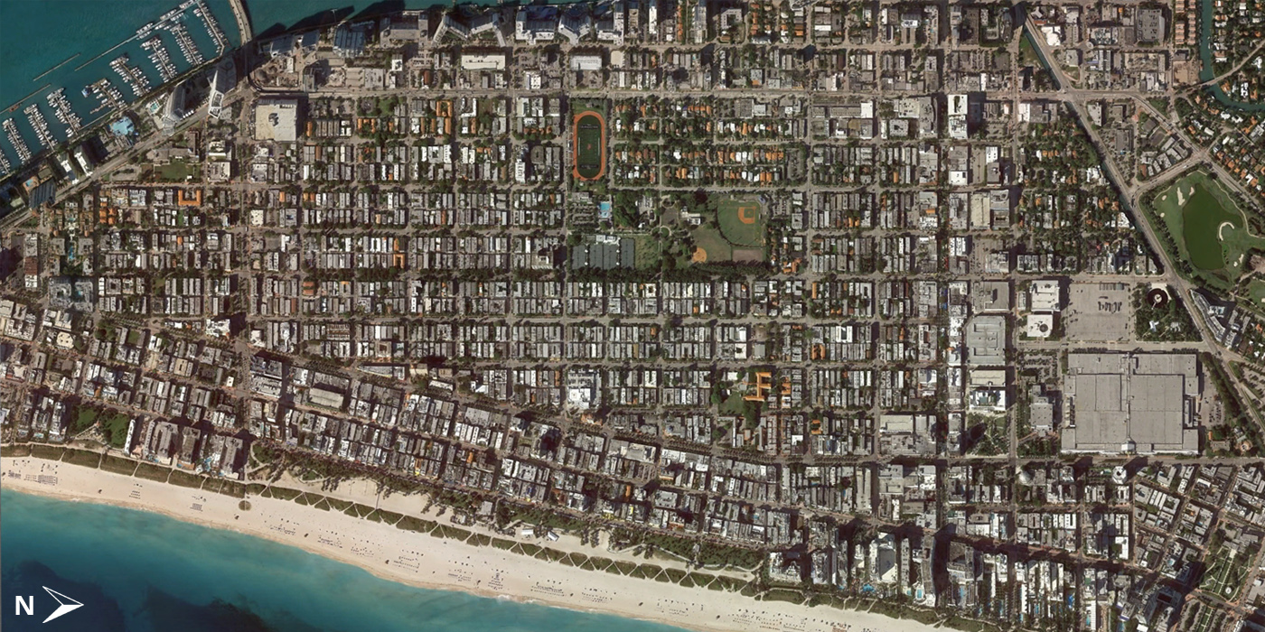
South Beach, 1961 to 2014
Starting this post with a contrast to the incredible urban renewal clearance seen in almost all American downtowns we’ve looked at so far. Here’s an example where historic preservation has kept the South Beach neighborhood of Miami Beach remarkably intact, thanks to activists who at times literally chained themselves to Art Deco hotels in danger of demolition.
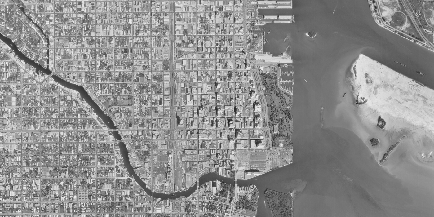
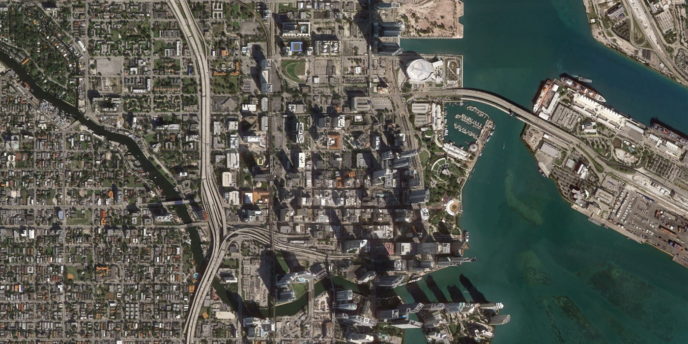
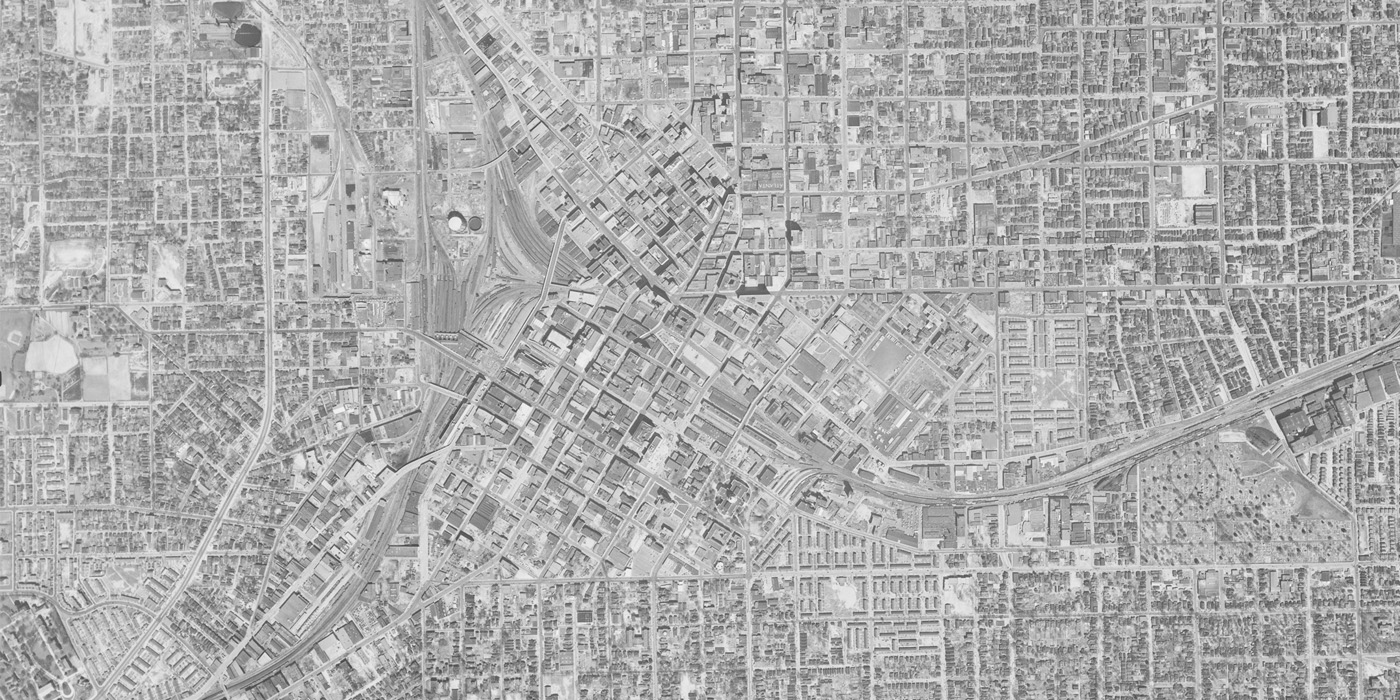
Miami, 1961 to 2014
In contrast to many of the rust belt cities from the Midwest sliders, many of the cities in the southeast have experienced tremendous growth. This is clearly visible in the case of Miami, where the 2000s saw 83 towers and 23,000 condos added in the downtown area in the boom prior to the housing crash. In the wake of the recession, Miami’s building boom is back on.
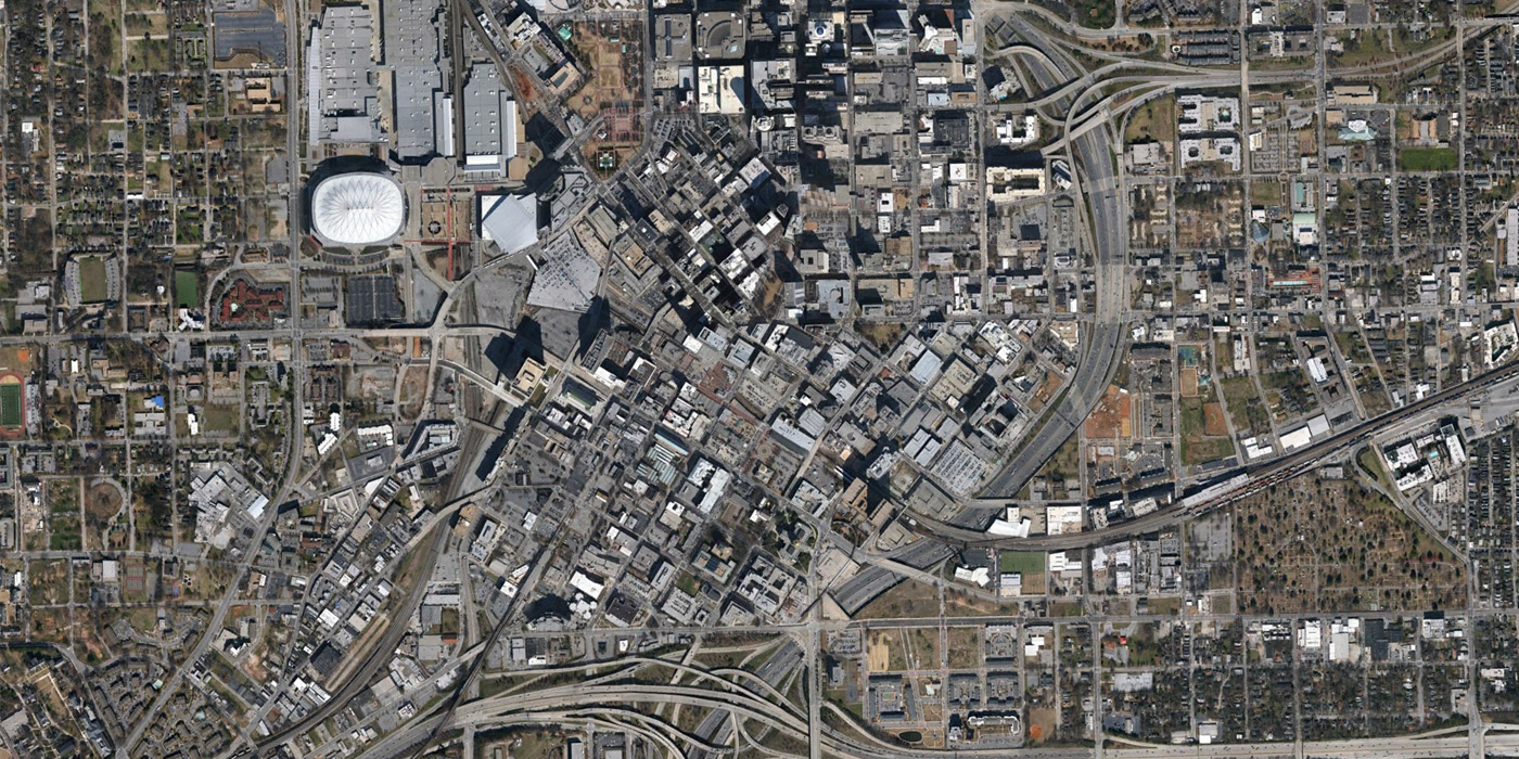
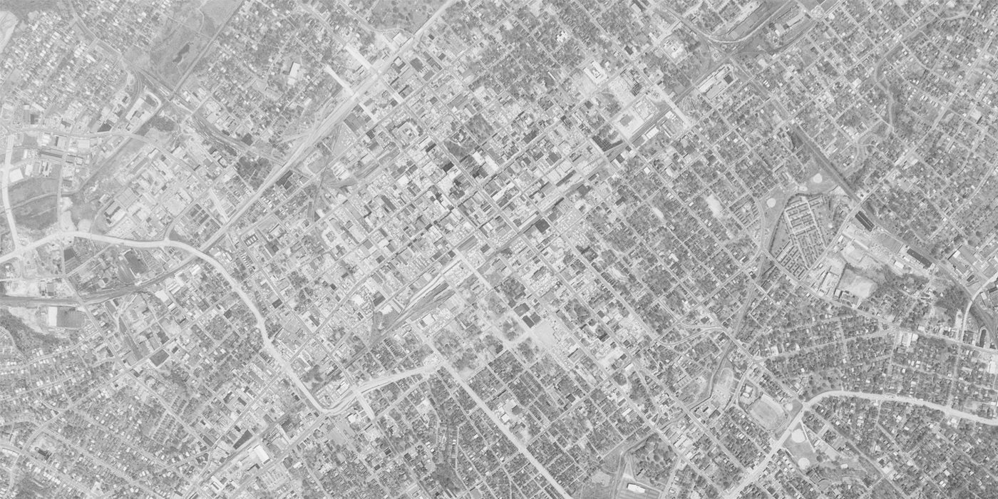
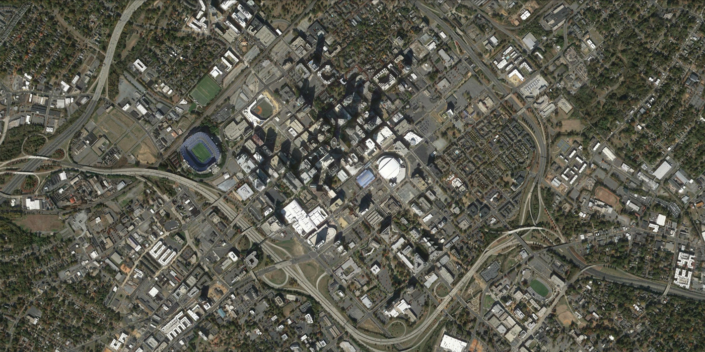
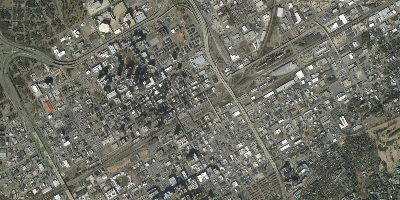
Atlanta, 1952 to 2013
Major highways and interchanges are a dominant feature of Atlanta’s changed landscape. Northwest of downtown, a major change is the large civic complex including the Georgia Dome, Georgia World Congress Center, and Centennial Olympic Olympic Park. Very little of Atlanta has remained unchanged by the city’s growth.
[Update: Curbed Atlanta has provided an overview of the changes in this image.]
Charlotte, 1964 to 2014
Charlotte is one of the most dramatic sunbelt boom stories of the last half century, with a city population that has quadrupled since 1960. The city’s spectacular growth over the last 20 years has transformed it from a small city to one of the most dramatic skylines in the country. The I-277 freeway loop demolished large areas to circle Uptown Charlotte. A recent study seems to have dismissed promising changes to the freeway, such as a cap or surface boulevard, and for now the freeway will remain.
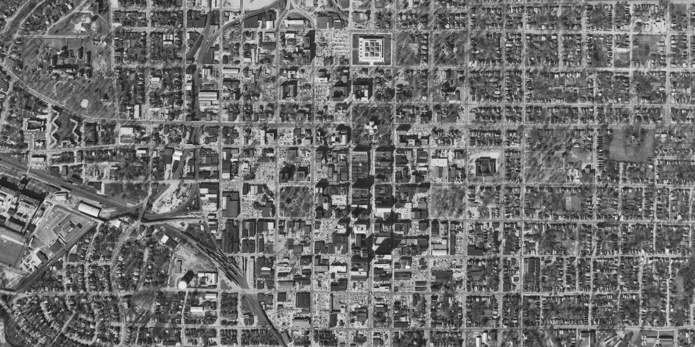
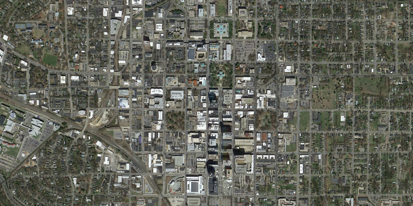
Raleigh, 1965 to 2014
Highway construction had little to no impact on the street grid of downtown Raleigh. US 70, the major highway running through the downtown, splits into a couplet of one-way streets in the area, similar to Peter Calthorpe’s Urban Network concept that has been employed in some new urbanist projects. Modern buildings have grown in Raleigh, but Fayetteville Street, running on the axis of the State Capitol, is still clearly visible as heart of the city.
Birmingham, 1947 to 2013
Birmingham saved a large portion of its central city, including theater and retail districts, from urban renewal. Today, revitalization efforts are ongoing to bring life into the historic districts. The railroad that has run through the center of downtown has become a focal point with the construction of Railroad Park and a new baseball stadium.
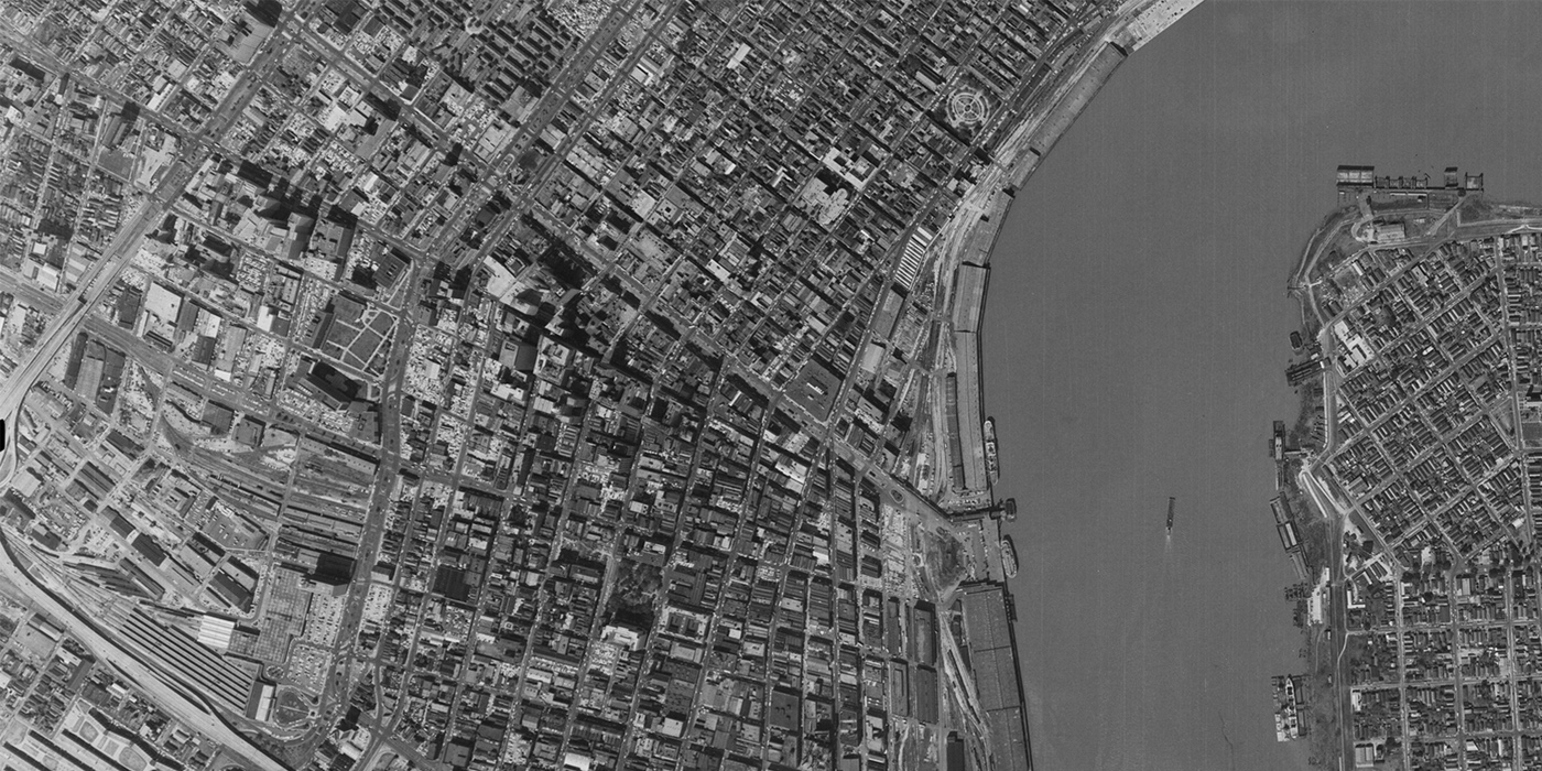
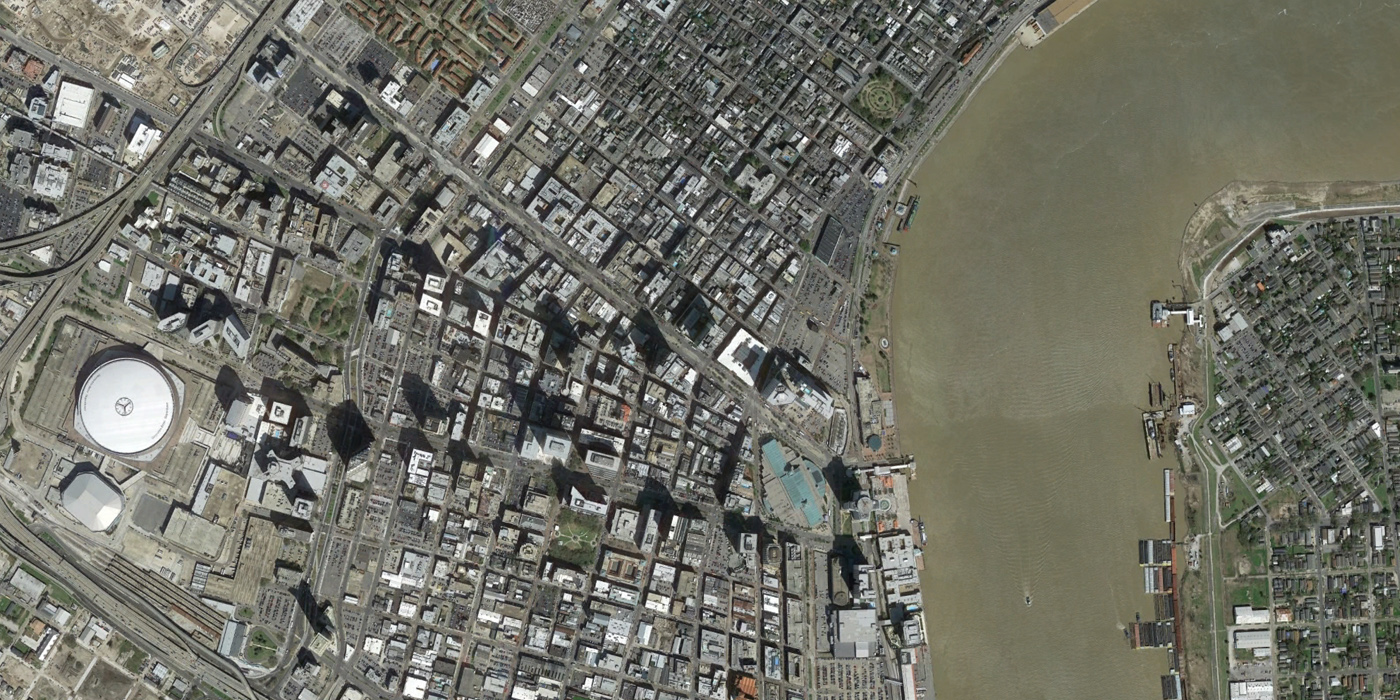
New Orleans, 1964 to 2014
New Orleans is known for its well-preserved downtown and French Quarter, where preservation efforts began as early as the 1920s. However, New Orleans faced plenty of the same urban renewal battles in the 1960s. A plan to construct an expressway along the riverfront (planned by Robert Moses himself), which would have placed an elevated highway between Jackson Square and the Mississippi River, was defeated by historic preservationists in 1969.
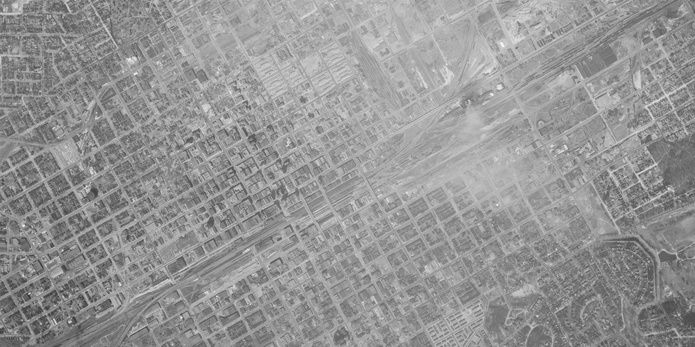
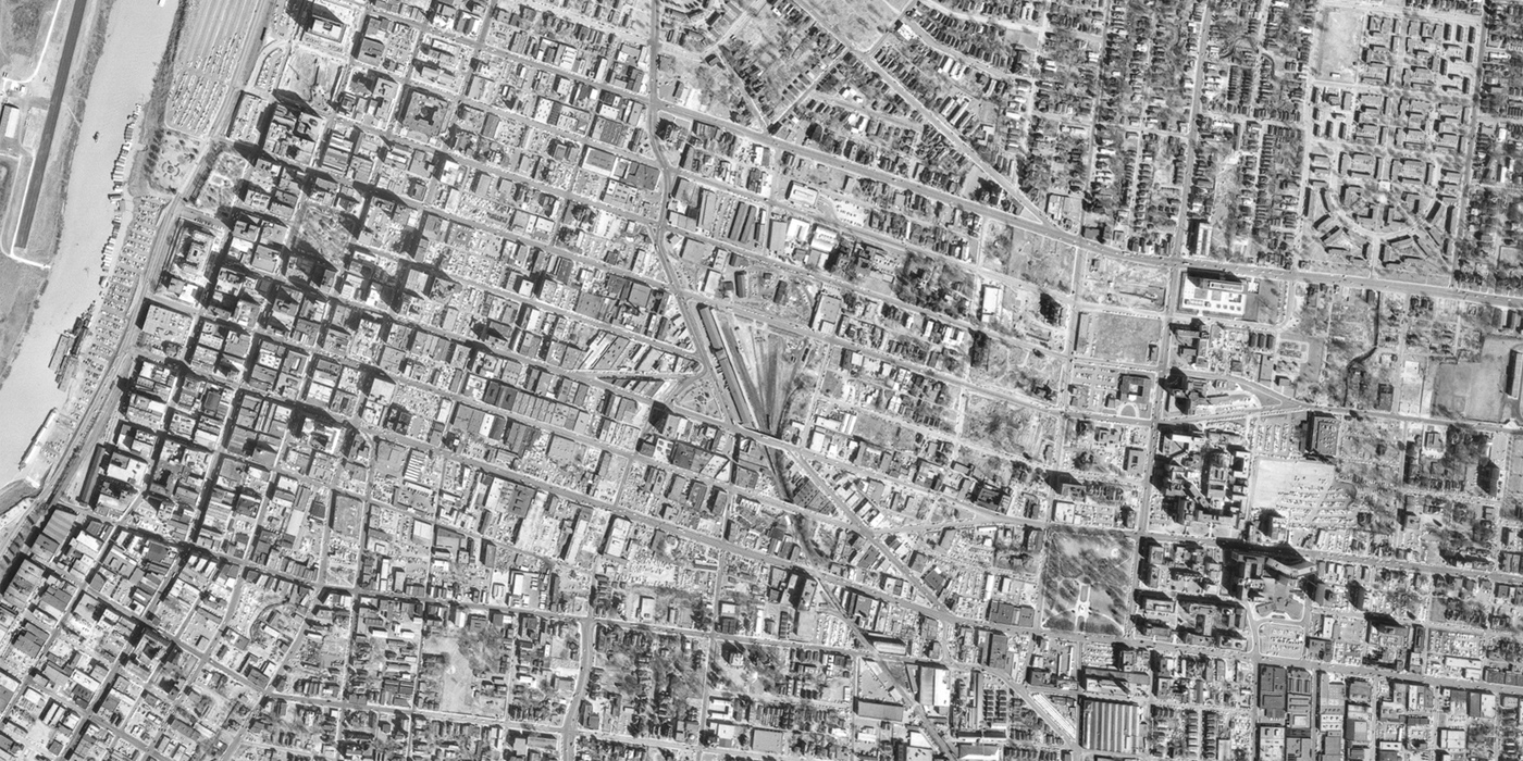
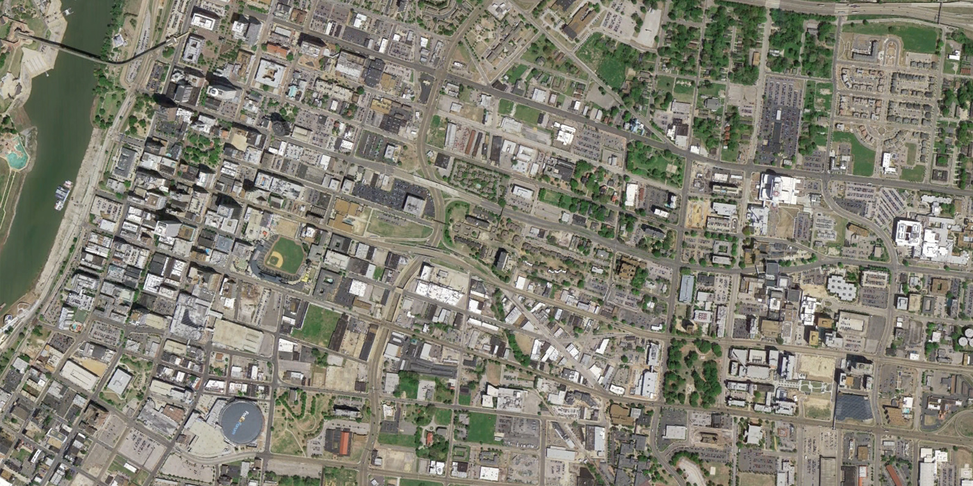
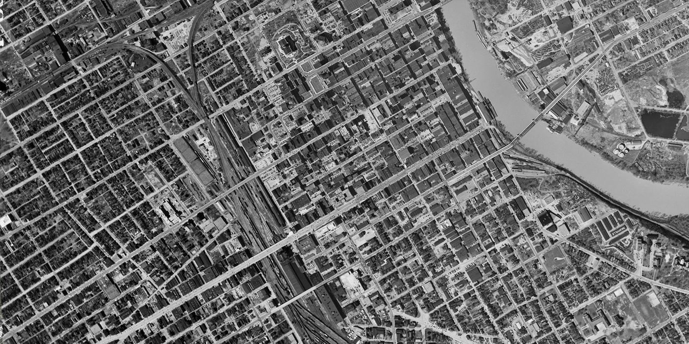
Memphis, 1963 to 2014
The images of central Memphis show how the city’s building stock thinned over 50 years. Today, the most popular destination in Memphis is Beale Street, shown in this image near the lower left, north of the FedEx Forum. However, the slider shows how much of this district was lost to urban renewal prior to national recognition of the area as a place of national cultural importance for its music history.
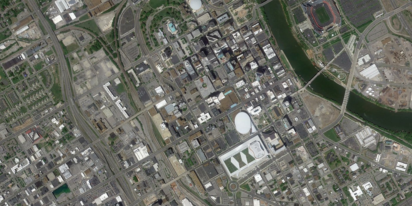
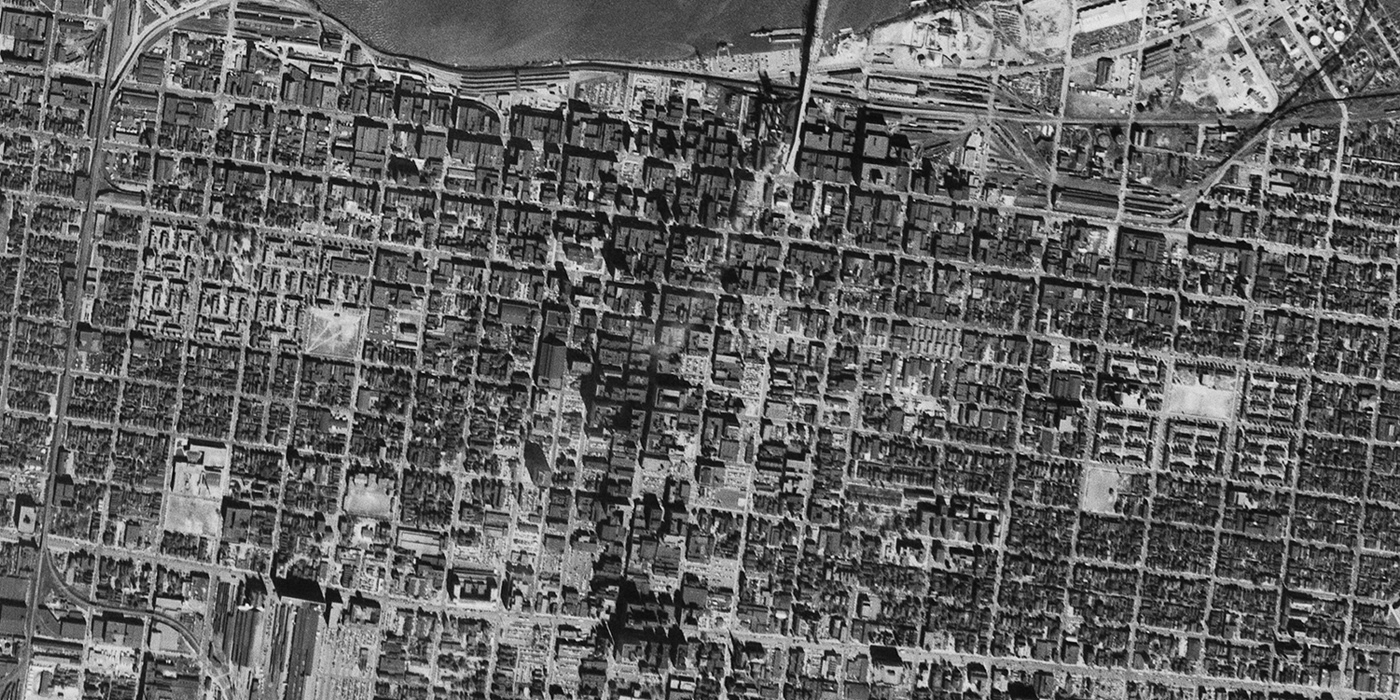
Nashville, 1951 to 2014
Large swaths of Nashville neighborhoods were destroyed by the Capitol Hill urban renewal plan and the construction of I-65, replaced with housing projects that isolated impoverished residents. Nashville’s urban renewal history is documented in this article. Modern changes are striking in Nashville too, such as the green roof on the large new convention center constructed on land that was previously cleared as surface parking.
Louisville, 1952 to 2014
Louisville experienced major losses to the city’s African American neighborhood of Old Walnut Street (now Muhammad Ali Boulevard). Surface parking lots and interstate highways I-64 and I-65 dealt major blows to commercial and residential neighborhoods shown in this slider. I-64 also cut Louisville off from its riverfront, where a new Waterfront Park has restored some access to the Ohio River. Citizens recently won a battle against a proposed $2.6 billion expansion of the riverfront highway interchange that would have been built over the park’s Great Lawn.
[Update: Louisville Courier-Journal has provided additional comments on the changes in this image.]
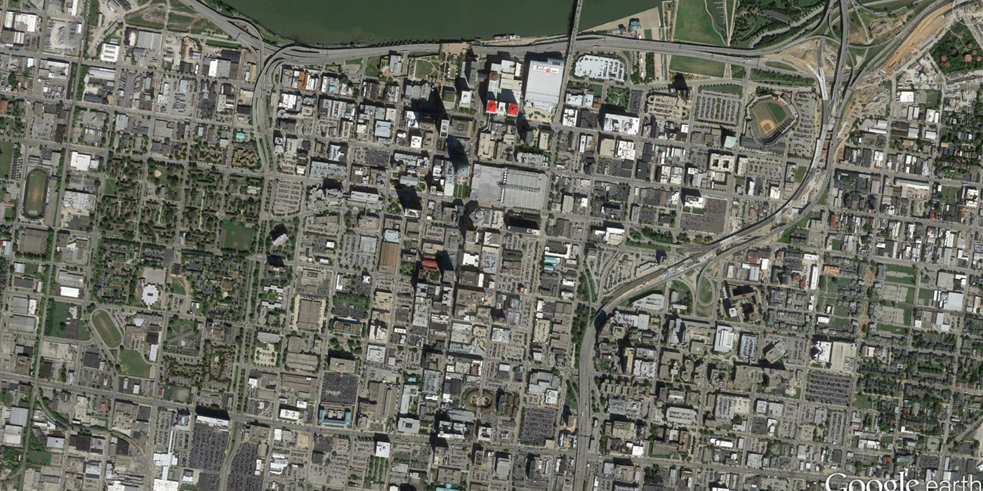
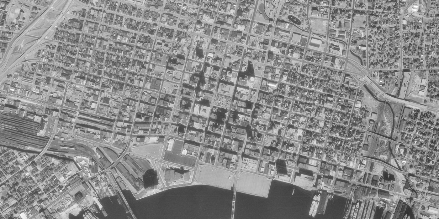
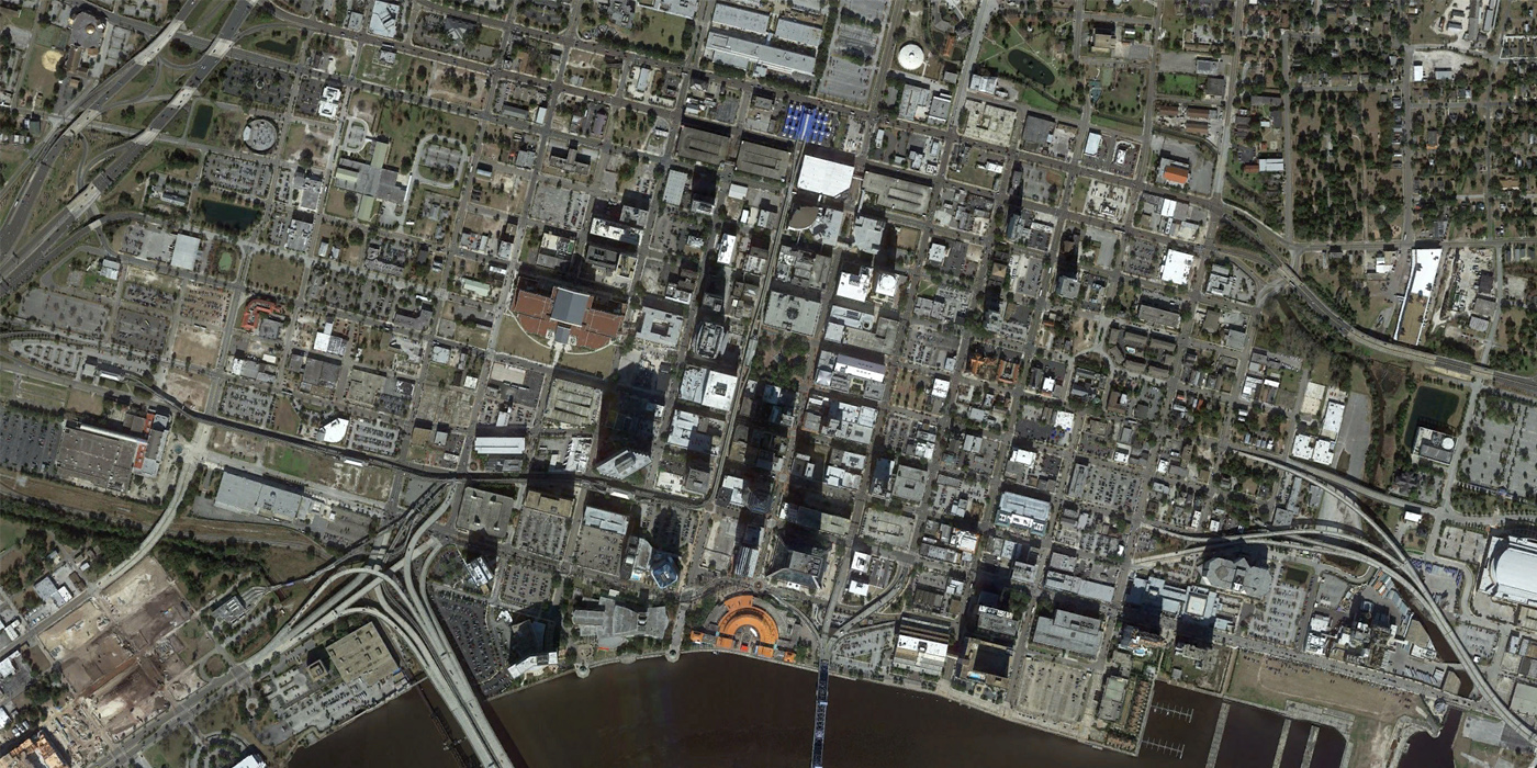
Jacksonville, 1963 to 2014
Jacksonville experienced significant urban renewal losses in the downtown area shown in these sliders. The western portion, known as La Villa (profiled recently by MetroJacksonville), was especially hard hit and remains mostly vacant. Some of the worst stories come from the Sugar Hill neighborhood, where 75% of the neighborhood’s prominent, successful African American residents were relocated.
I’m pretty sure not a lot has changed in the Louisville interchange project … It’s been revised to look like this: http://kyinbridges.com/wp-content/uploads/gallery/kennedy-exhange/bridges_images__0001_2.jpg
It’s still an eyesore, and the new bridge will pave over a decent sized chunk of waterfront park.