
60 years has made a big difference in the urban form of American cities. This visual tool is a way to review the scope of these changes. In many cases, the most notable changes are a legacy of the urban renewal programs and planning of the mid-century period. This often meant the clearance of large swaths of developed urban land, especially downtown districts and Black, immigrant, or low-income areas and replacement with freeways, institutions, and mega-projects. For additional context and readings, visit the project homepage.
We put together these sliders to show how cities have changed over half a century.
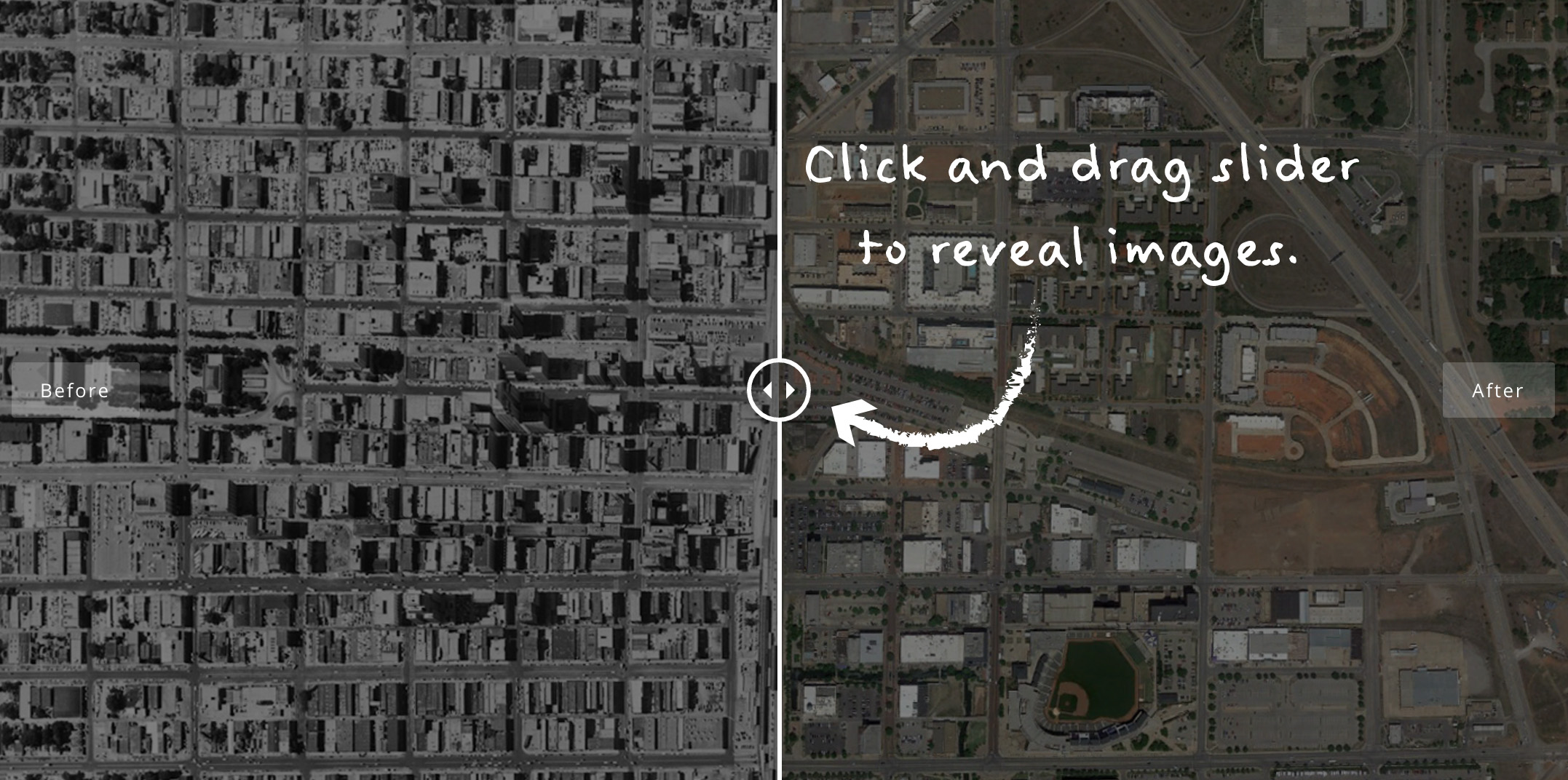
How to Use
Click and drag the slider as shown in the image below to compare images.
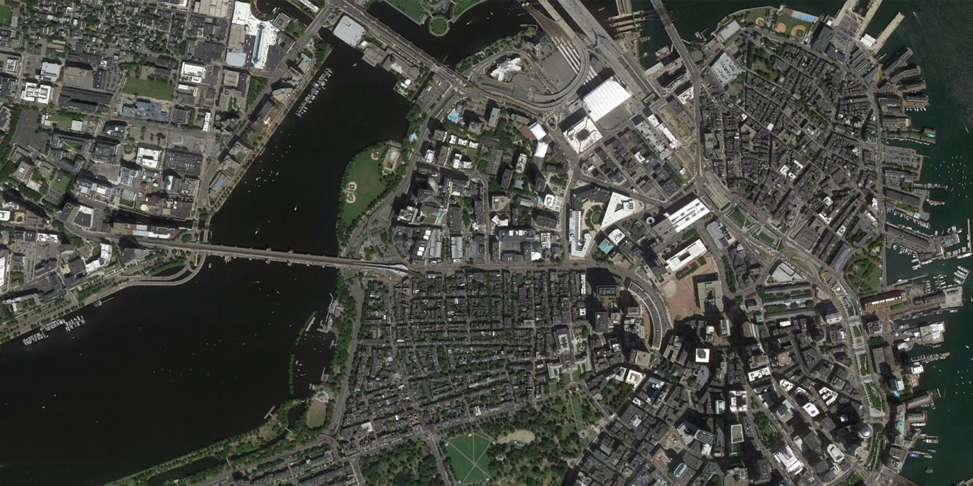
Boston, 1938 to 2013
Dating from 1938, this Boston aerial image is one of the oldest available dates. Boston’s most dramatic urban renewal story is probably the clearance of the West End neighborhood, in the top center of the photos. Only a handful of landmarks were preserved in this area, which was a Jewish and Irish working class area. According to the West End Museum, a third of old Boston was lost to urban renewal. In contrast, the North End and Beacon Hill neighborhoods are wonderfully preserved historic districts.
Another notable change is the path of the Central Artery, once an elevated highway that has now been buried through downtown in “The Big Dig.” Project for Public Spaces has said “there is no square as terrible and bleak” as Boston’s 7-acre City Hall Plaza, the red-paved square at the center of the image. New mayor Marty Walsh recently announced that redesigning the plaza will be a priority of his term.

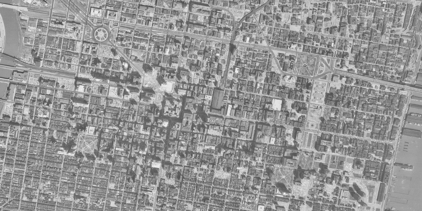
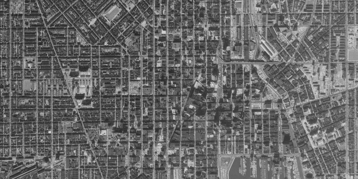
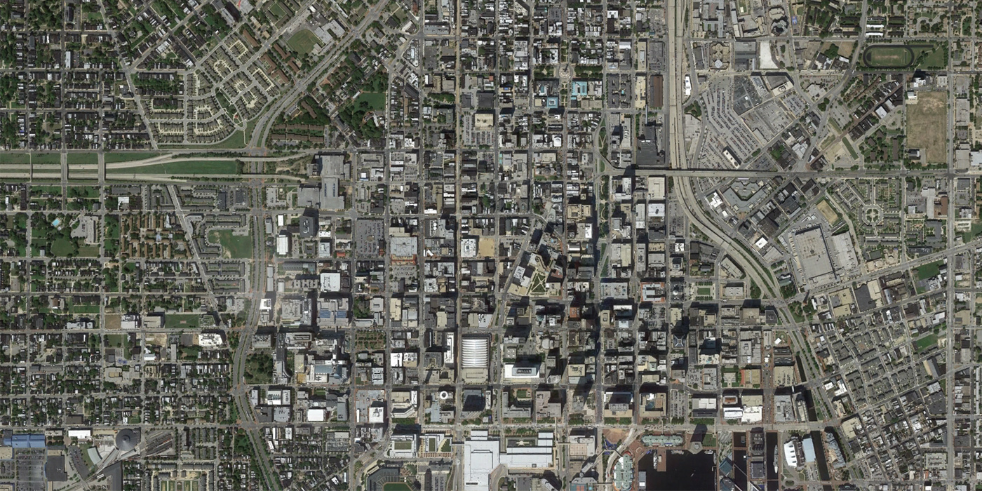
Philadelphia, 1965 to 2014
I-95, along the Delaware River east of Center City Philadelphia, is one major change visible here, along with highway interchanges and connections into the city. The Pennsylvania Convention Center also takes up several square blocks. Additionally, near the center of the photo, a large enclosed mall replaced several blocks as the city attempted to compete with the suburbs. Much of Philadelphia’s architectural change can be attributed to architect Vincent Kling and planning commissioner Edmund Bacon.
[Update: Philadelphia Magazine has provided additional comments on the changes in this image]
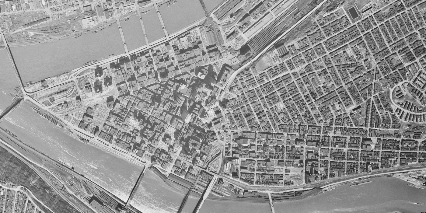
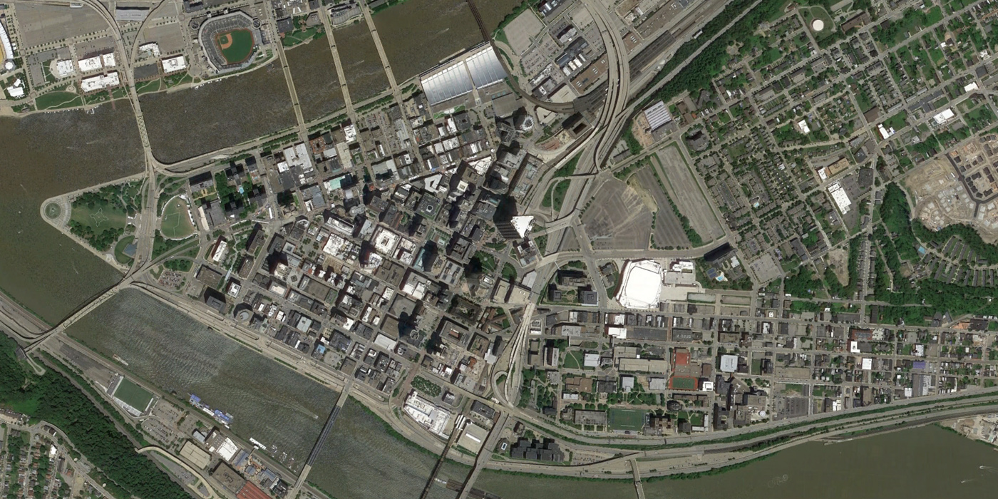
Pittsburgh, 1952 to 2014
Pittsburgh is another city with a shocking urban renewal history, particularly in the areas east of downtown, the Lower Hill District and Hill District. Thousands of structures were destroyed for facilities like Civic Arena, which has now been destroyed and slated for redevelopment. The Hill District was a prosperous African American neighborhood that descended into crime and poverty during the urban renewal period and was further destroyed by riots following the assassination of Martin Luther King, Jr.
Baltimore, 1959 to 2010
One of Baltimore’s infamous urban renewal scars is known locally as the ‘highway to nowhere.’ Originally envisioned (with help from Robert Moses) as a 22-mile route, only 1.4 miles were constructed as a below-grade highway extending west from downtown, demolishing dense residential neighborhoods. Advocates hope that the highway will be removed and restored as a productive neighborhood. Running north to south, Martin Luther King, Jr. Boulevard is considered a dividing line between downtown and predominantly black West Baltimore. More than 25,000 people, 85% African American, were displaced during the urban renewal period in Baltimore.
Buffalo, 1963 to 2014
The 1963 aerial of Buffalo (note that the images are rotated from true north to show more of the downtown area) shows the city’s dramatic elevated “Skyway” already in place. Much of Buffalo’s urban renewal transformation took place in the 1950s, before this image was captured. However, additional changes to the street grid occurred, such as the severing of Genessee Street, one of the radial axes from Niagara Square all the way to the outskirts of the region.
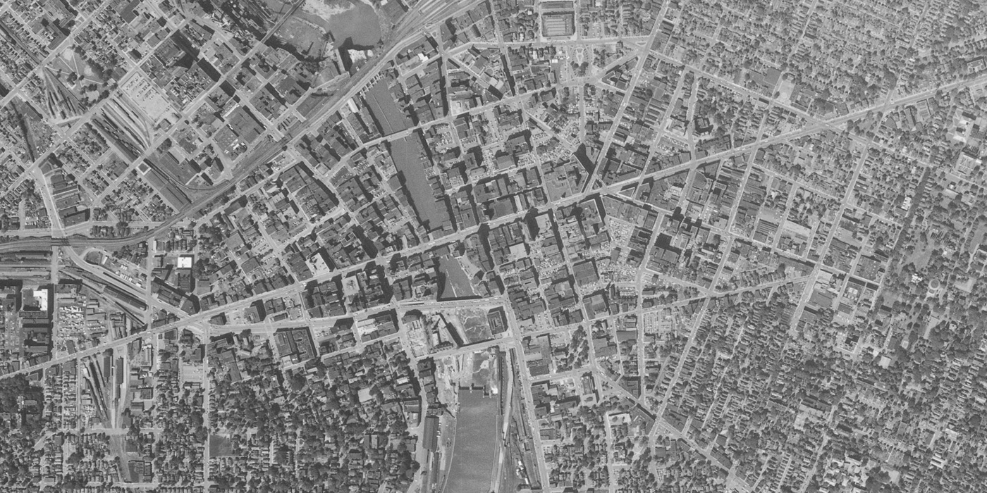
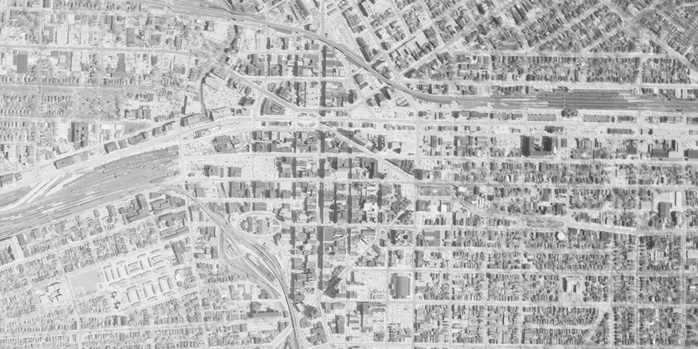
Rochester, 1951 to 2014
In Rochester, the Inner Loop Highway was constructed in the early 1950s, forming a complete loop around the center of the city. The eastern portion of the loop carries as few as 10,000 vehicles per day. A proposal to replace this section with an urban boulevard is now underway.

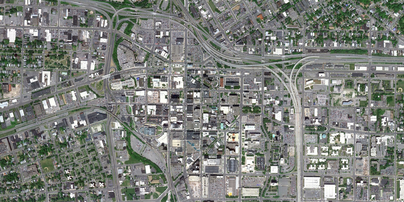
Syracuse, 1956 to 2011
From the air, the oval surrounding the historic Syracuse Armory and several historic squares have remained a part of Syracuse’s urban fabric even as many commercial and residential blocks gave way to surface parking. I-81 and I-690 were constructed as elevated highways through downtown Syracuse, meeting in an expansive elevated interchange. The I-81 corridor is being evaluated for the potential to replace the highway with a surface boulevard. [Update 11/23: Alana Semuels at The Atlantic has written a great piece on urban renewal focusing on Syracuse.]
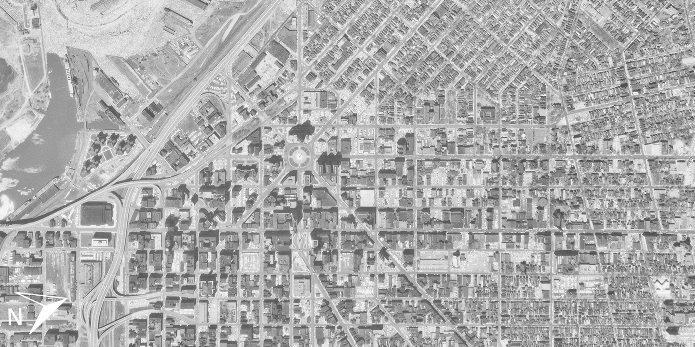
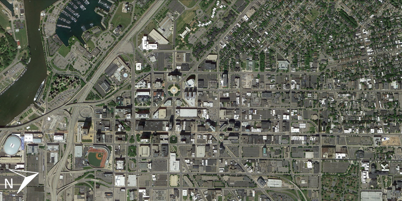
Albany, 1952 to 2013
Several massive-scale transformations are visible in Albany, most significantly the brutalist state government complex Empire State Plaza, or South Mall, constructed in the 1960s and 70s. Along with I-787 and the South Mall Arterial access road, this development replaced huge portions of Albany’s urban core. A new documentary film tells the story of this clearance project that displaced 3,500 families. Watch the trailer here.
[Update: All Over Albany has provided additional comments on the changes in this image.]

Providence, 1955 to 2013
The 1955 image of Downcity Providence (rotated from true north to fit greater area) shows the city as it was before the construction of I-95 along the west edge of downtown. The highway and other urban renewal projects in the late 1950s and 60s took out hundreds of homes and businesses, and many business owners never recovered from relocation in Providence. Additional large-scale clearance is visible south of the downtown (lower left of images), where a medical campus and associated parking has spread into the neighborhood.
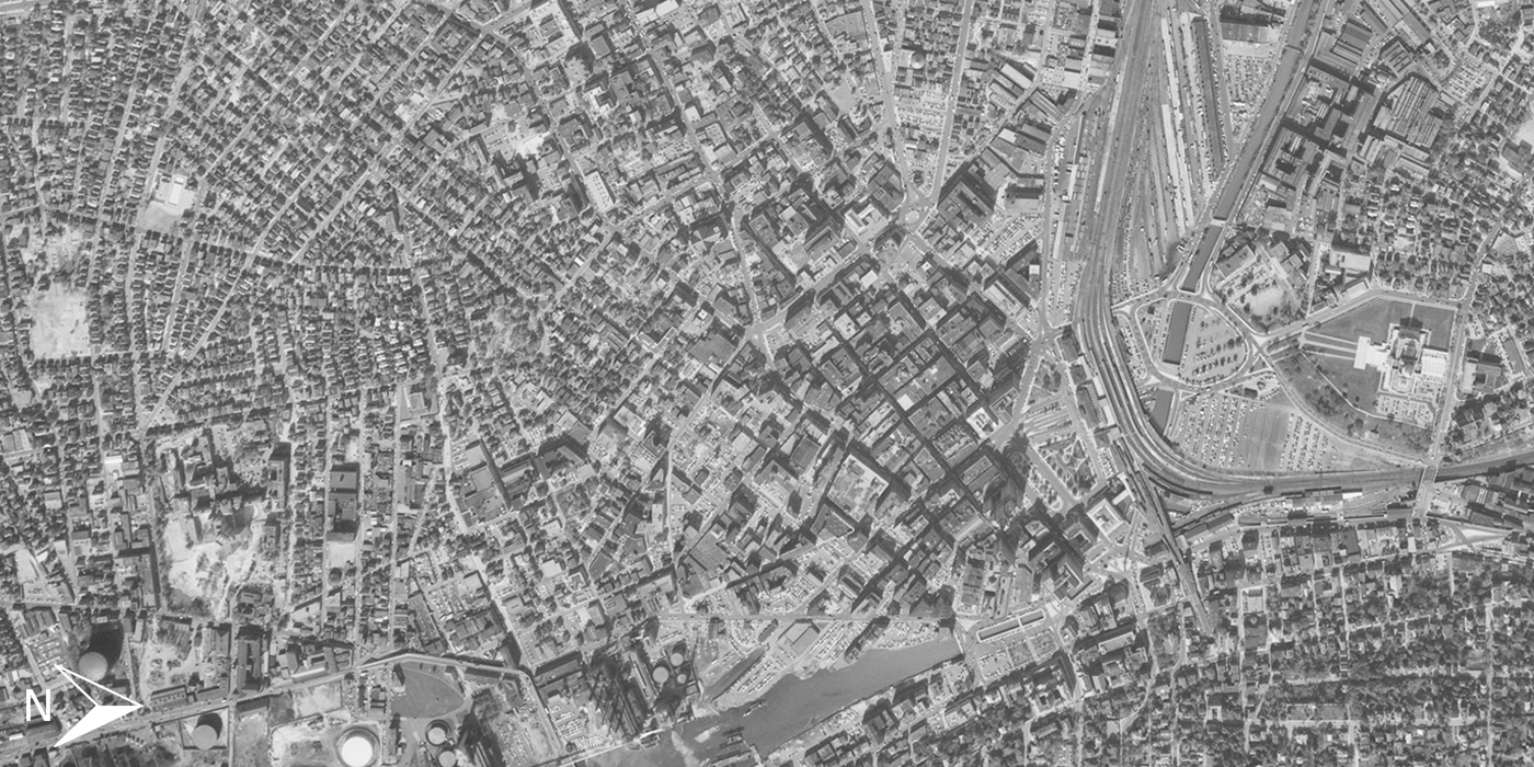
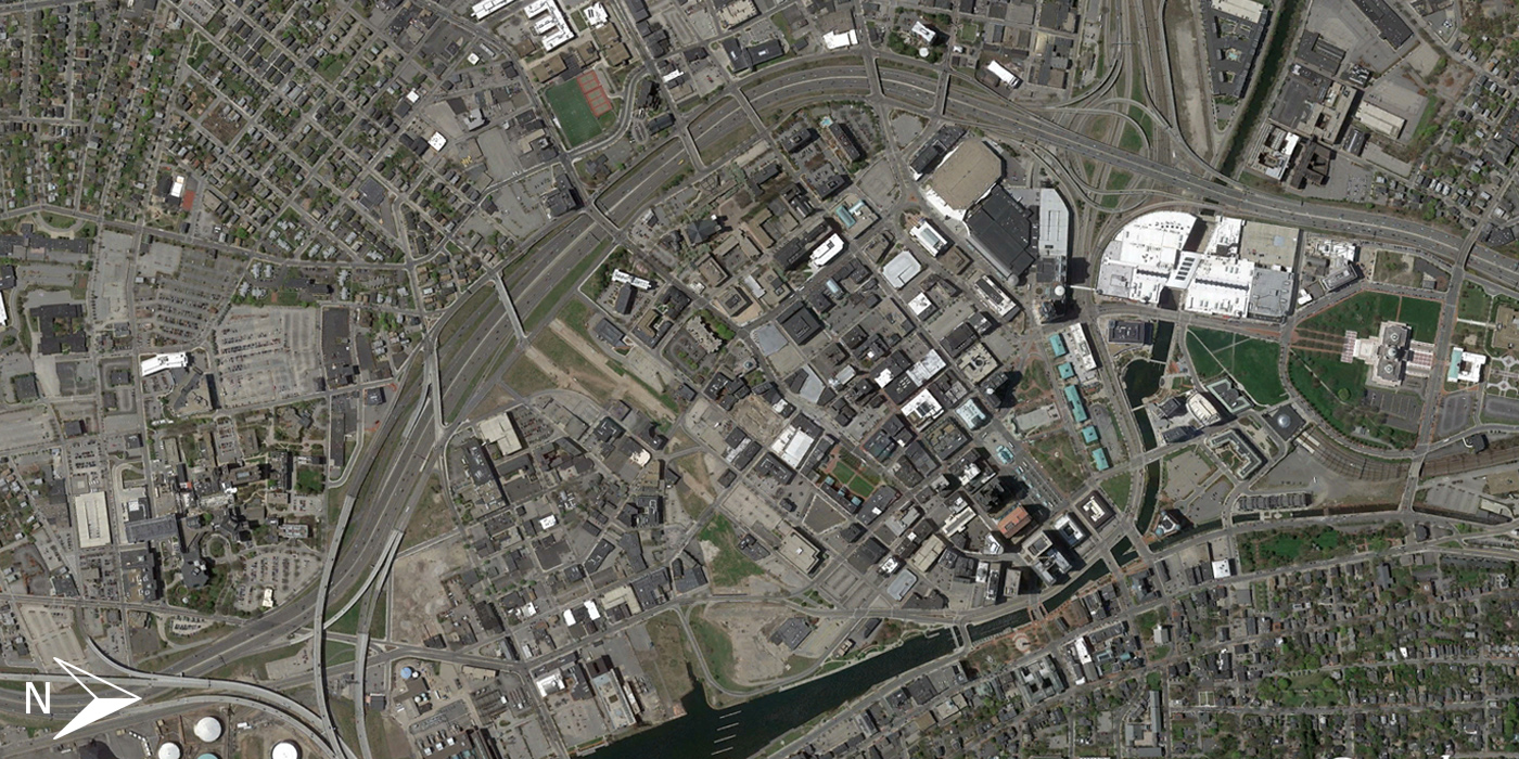
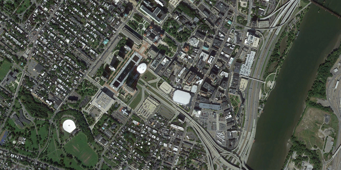
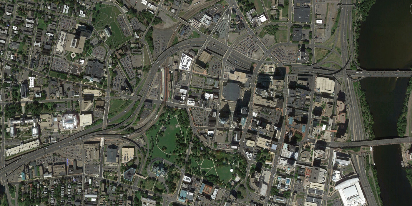
Hartford, 1959 to 2013
Hartford’s Bushnell Park, adjacent to the Connecticut State Capitol, is still prominent in the city’s urban form. However, much of Hartford has been transformed by the urban renewal era. Today, more than 20% of land downtown is used for parking. In the 1959 aerial, clearance and highway construction is already underway near the river. The I-84 corridor, below grade north of downtown and an elevated viaduct as it winds around to the west, carries some of the heaviest traffic volumes in the state. However, the viaduct has been identified as a ‘futureless freeway’ and leaders are considering how to deal with this piece of infrastructure.

any chance there’s one about the bronx?
We will provide a few images from the NYC area in a future post.
Mille grazie to IQC & Shane Hampton for sharing this important information. The South End of Albany NY, once a vibrant ethnic center, is now called “The Parking Lot District. ” Grazie for linking our documentary, “The Neighborhood That Disappeared,” to your discussion of the scars left by massive urban renewal projects throughout America.
Totally fascinating, extraordinarily well done, with great commentary. Eager to see what comes.
How about some west-coast cities? I know we’ve torn down a few, but places like Sacramento were tore up with freeway building surrounding downtown and still show it.
Some west coast cities are coming soon.
These are great, but I would love to see more interactivity in the maps, maybe something like this: https://www.mapbox.com/blog/before-after-moore-tornado/
Why was Cleveland used in the animated gif, but not as one examples?
You can find the Cleveland images on the Midwest page: http://iqc.ou.edu/2014/12/12/60yrsmidwest/
This makes me terribly sad. The urban cores were sacrificed to suburban commuters and inter-city traffic. Albany, for example, could have more than 10,000 additional people and hundreds of additional businesses had the urban renewal not taken place. Beautiful 19th Century architecture was forever destroyed.
I was born in Rochester, New York, 1955. My father, Frederick Troicke, was a champion to try to revive the subway system and provide rapid transit via rail to the south of the city. He ran for City Council in 1967 under the Liberal Party ticket, but was not elected.. My father also managed Simplex Tours. The yacht Venera with Captain Sam Tiapak departing from the east side of the Genessee River just north of the Clarissa St (now Ford St) bridge took many on boat tours on the Erie-Barge Canal. I remember the rail road switch-yard near that location.
My father passed away December 31, 1967. The rail lines were torn out for urban renewal. The subway dream not revived. Rapid transit became the bus system..
Thank you Adam, for sending these time comparisons of some of our great American cities. May we learn from our past mistakes, especially in transportation systems.
Great post! But one correction is needed: The Empire State Plaza in Albany is not part of the Brutalist movement. Brutalism is known for exposed concrete, but the Plaza has none; rather, it is clad in white marble. The Plaza in fact belongs to the International Style in much the same way as do the United Nations Headquarters and the Metropolitan Opera House, which were designed by Wallace Harrison (who also designed the Plaza). While it may appear brutal, it is not actually Brutalist.
Am I missing something? The Philadelphia “after” is not Philadelphia…
Nevermind…correct now.
I am a lifetime Philadelphian & do not recognize the after foto.
Utica, NY please.
Good God! Looking at Pittsburgh it appears the city is worse! Yes I now they got ride of the smoke and put some parks in place of defunct rain terminals. But Look at the far right, where there was once a vibrant neighborhood, The Hill District, is now an empty lot (former home of Civic Arena) and lots of unused parking, not to mention tons of abandoned lots. The density was lost all for an area that is now gone!! What pathetic planning. Shame on the city!!
Your comments about Pittsburgh have left out many changes to the city such as Point State Park, the Gateway Center Buildings, the Convention Center, many new hotels, development of the waterfronts on the three rivers, new roads and other progresses too numerous to mention. Pittsburgh is a gem. Go to Mount Washington and view the city at night. Too much is made of our accent and not enough of our accomplishments!