60 years has made a big difference in the urban form of American cities. This visual tool is a way to review the scope of these changes. In many cases, the most notable changes are a legacy of the urban renewal programs and planning of the mid-century period. This often meant the clearance of large swaths of developed urban land, especially downtown districts and Black, immigrant, or low-income areas and replacement with freeways, institutions, and mega-projects. For additional context and readings, visit the project homepage.
We put together these sliders to show how cities have changed over half a century.
How to Use
Click and drag the slider as shown in the image below to compare images.
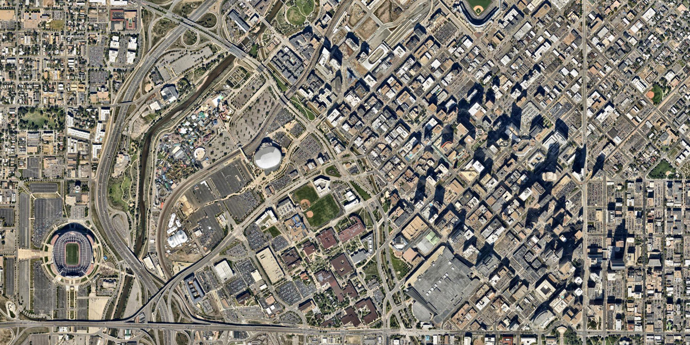
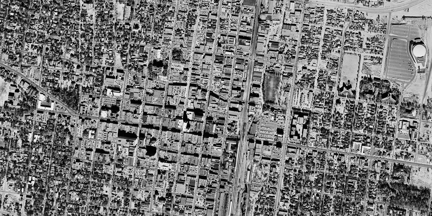
Denver, 1953 to 2014
Denver largely avoided large highways within the downtown area, but this 1953 image of Denver shows the beginnings of construction on US-87, which wraps around downtown to the west. However, Denver has had plenty of growth and change since the urban renewal period. The area west of downtown is most transformed, now the site of a theme park, the Pepsi Center, and the University of Colorado-Denver. This area included the working-class Auraria neighborhood, which was destroyed in the 1970s and is now the site of the University of Colorado Denver campus.
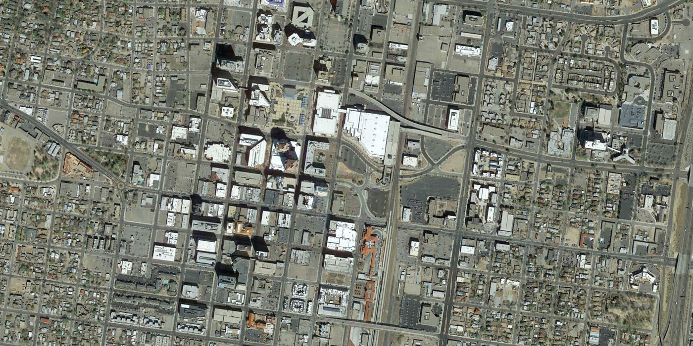
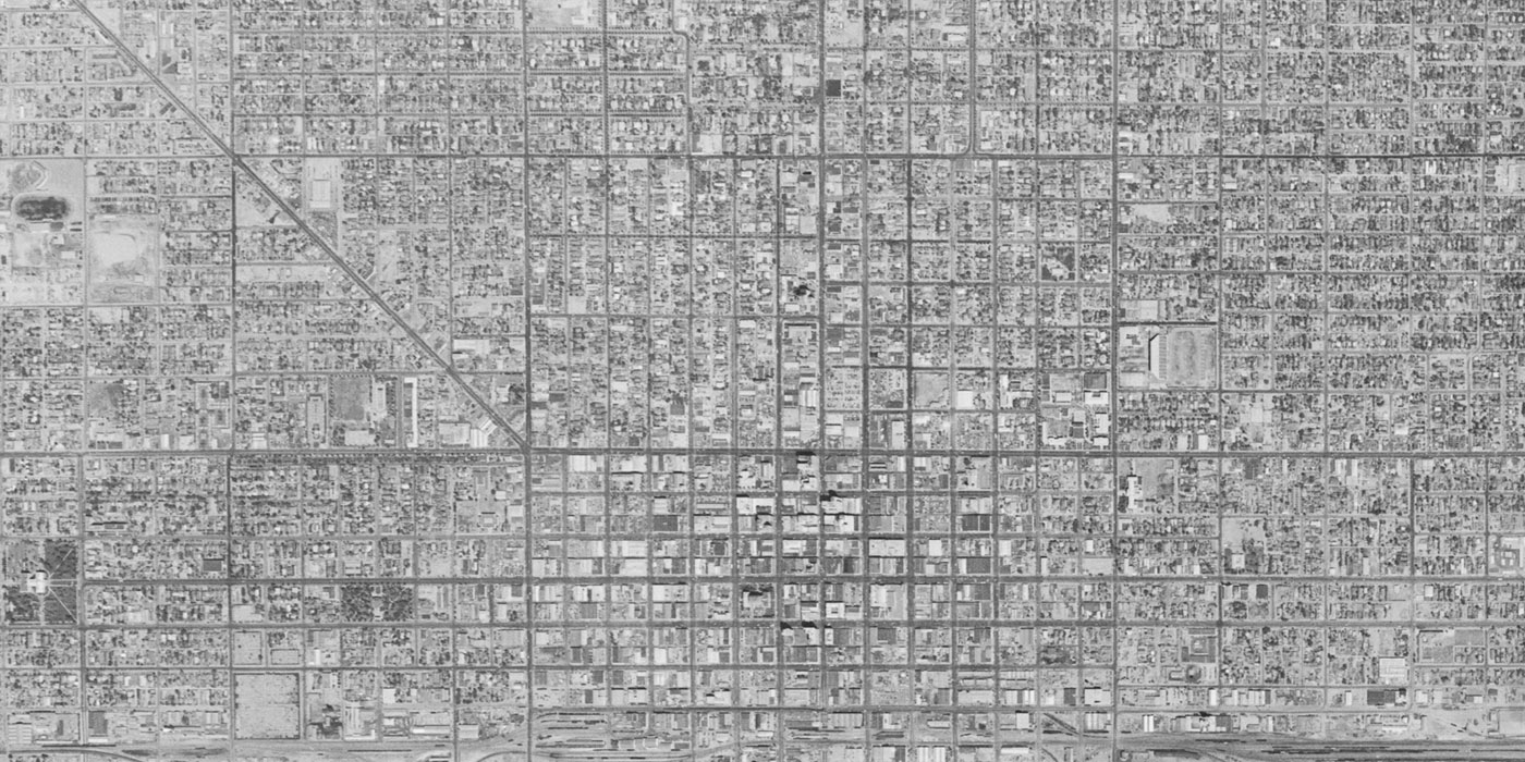
Albuquerque, 1959 to 2014
Like many other western cities, Albuquerque experienced huge population growth after World War II, growing from 35,000 in 1940 to 201,000 people in 1960. As the city grew, downtown was modernized with large surface parking lots and new buildings in the International style replacing much of the commercial district. Civic Plaza is the large open central open space that was constructed in this period. A recent Jeff Speck report recommended developing half of the plaza to cut back its massive scale. Additionally, a two-block pedestrian mall along 4th Street has recently been restored into a two-way street, so Albuquerque is undoing many of the changes that were made during the mid-century.
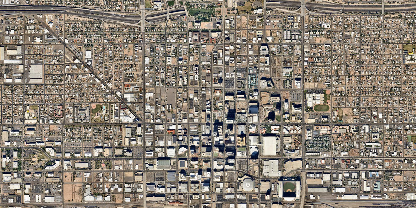
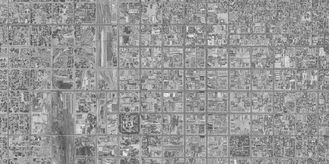
Phoenix, 1953 to 2014
The city of Phoenix grew from only 106,000 residents in 1950 to 1.5 million residents today, and its modern downtown reflects that most of the city has been built after mid-century. Changes to Phoenix’s street grid reflect modernist planning and traffic engineering, with one-way couplets and superblocks. I-10 snakes across the north edge of this image, briefly disappearing under a freeway cap that is the home of 32-acre Hance Park.
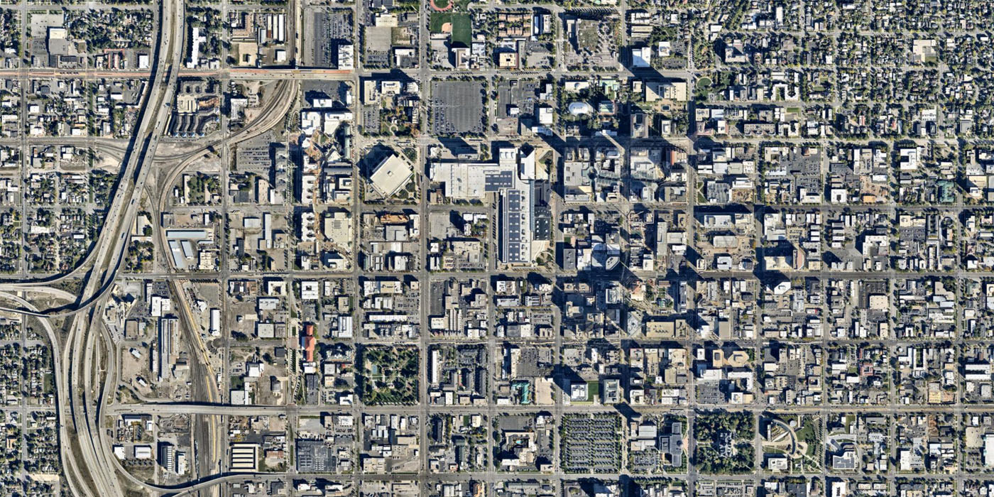
Salt Lake City, 1950 to 2014
Salt Lake City features the distinct Mormon Grid, with 660-foot, 10-acre blocks, yet the ubiquitous superblock still makes an appearance at the Salt Palace Convention Center. Temple Square, the heart of the headquarters of the Mormon Church, is in the center-top of this image. A more recent change is the City Creek Center south of Temple Square, a huge mixed-use development funded by the Mormon Church.
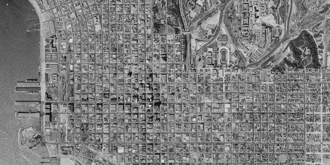
San Diego, 1956 to 2014
Since the 1950s, downtown San Diego has grown significantly. The construction of Interstate 5 through San Diego separated downtown from Balboa Park (northeast corner of image) and tore through neighborhoods like Little Italy north of downtown. Some have suggested that parts of I-5 could be capped with parks to reconnect the neighborhoods that were destroyed. Today, historic buildings are still being lost in exchange for parking lots, but modern infill development is visible throughout downtown San Diego.

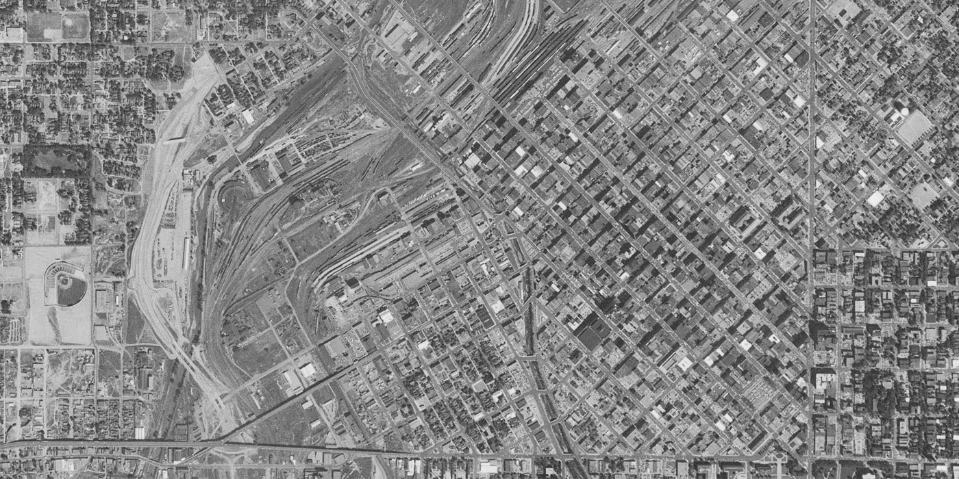
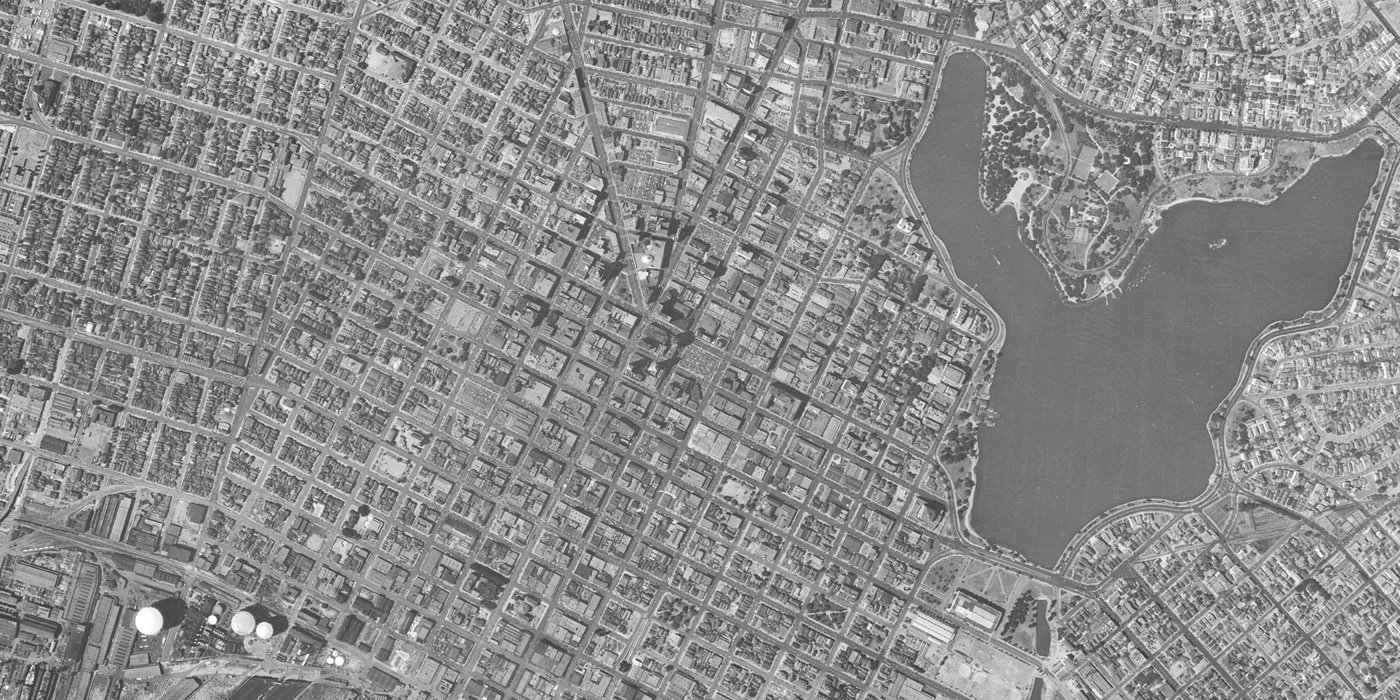
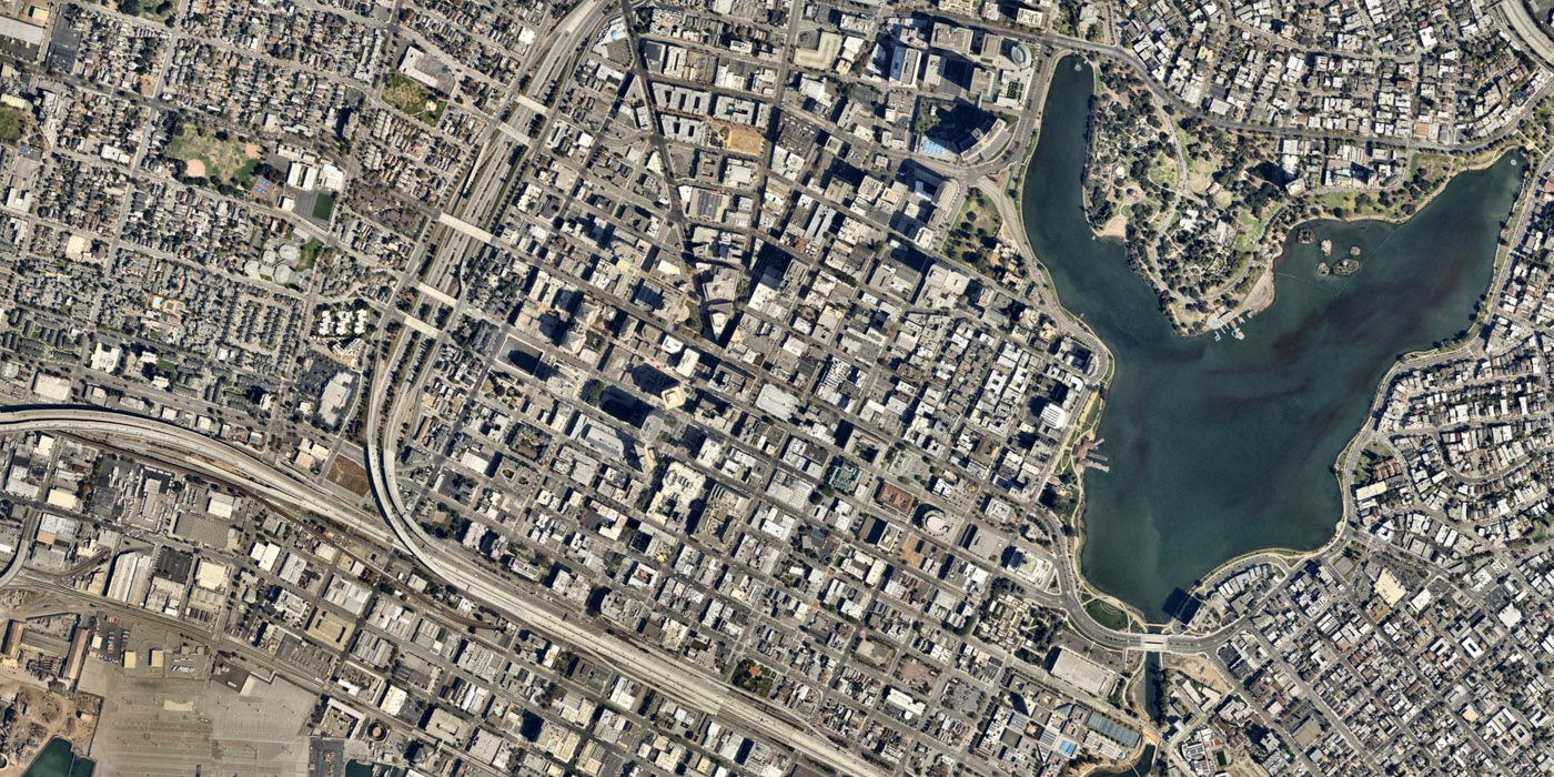
Oakland, 1946 to 2014
Oakland had several major stages of growth since it was incorporated in the 1850s. Traces of the original 1852 plans remain. Lake Merritt is a quickly identified constant in downtown Oakland, even as the rest of the city has densified with infill around it. The construction of the Nimitz Freeway and I-980 cut through downtown neighborhoods. The urban renewal period in Oakland displaced many people, particularly the Latino and African American communities, and the resistance to urban renewal in West Oakland may have contributed to the city’s place at the heart of the Black Panther Party.
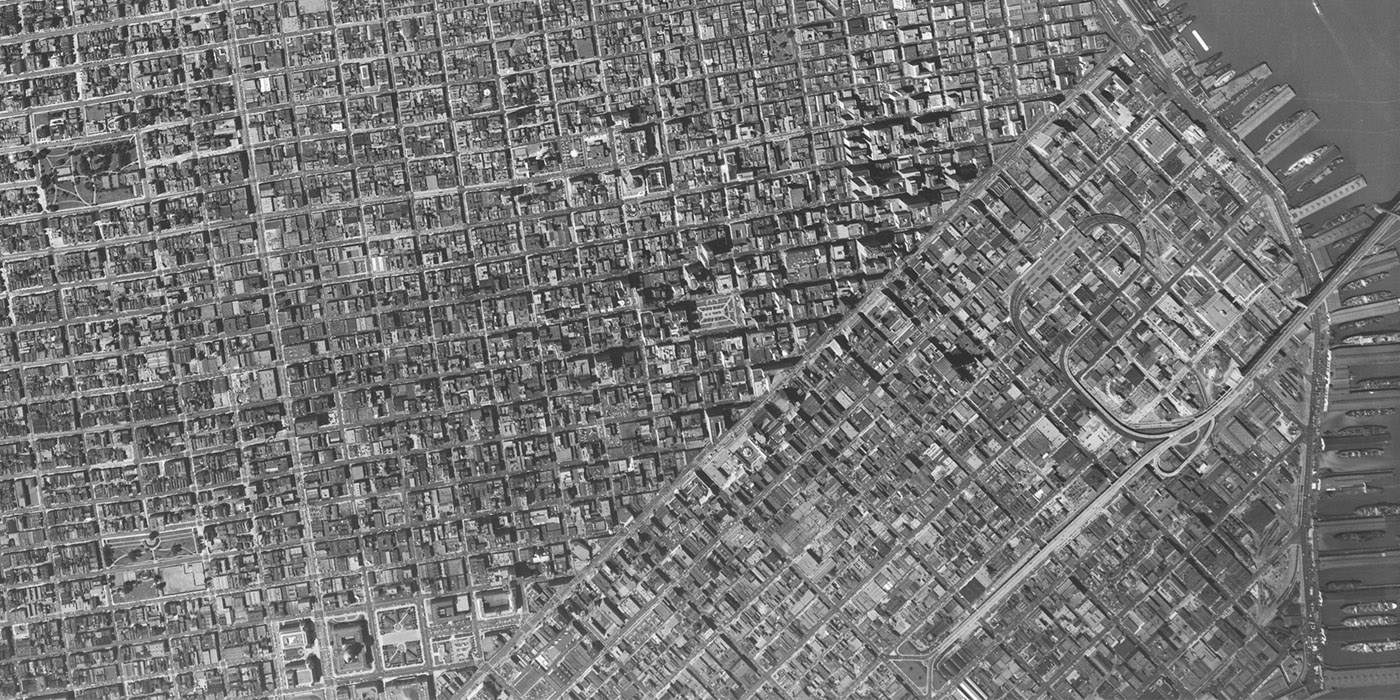
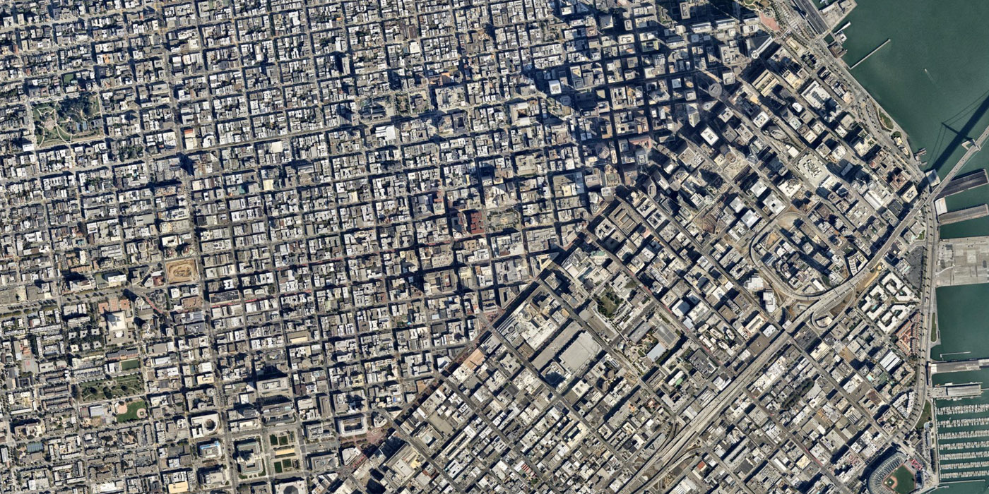
San Francisco, 1946 to 2014
San Francisco’s SoMa (South of Market) District was changed dramatically by urban renewal, particularly the 78-acre site of the Moscone Center and Yerba Buena Gardens. Another large redevelopment project is visible in the modern aerial image of San Francisco, at the Transbay Center development- Which has not gone without controversy. Check out additional sliders showing more recent changes in particular locations at Curbed San Francisco.
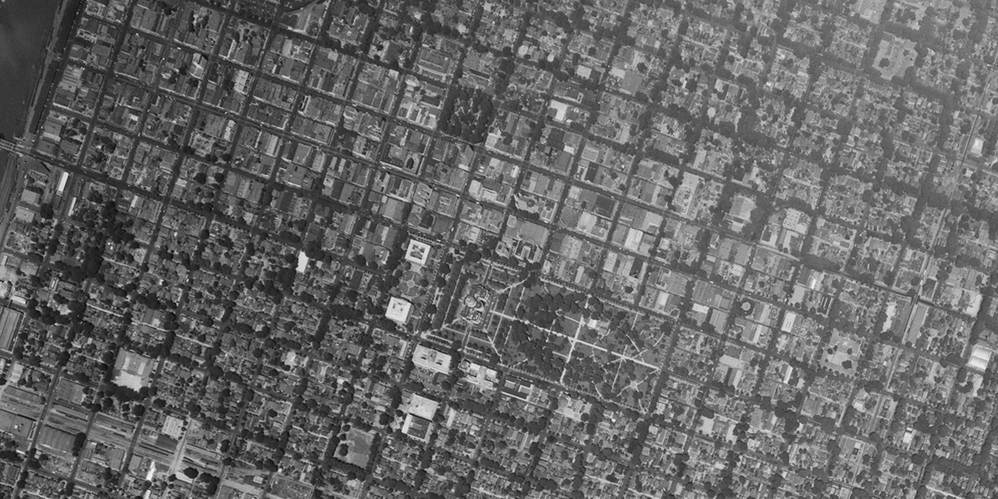
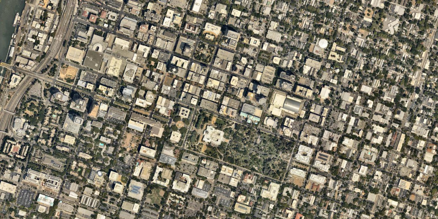
Sacramento, 1947 to 2014
The State Capitol is at the center of this image of central Sacramento, and California’s 1977 Capitol Area Plan has been a major driver of change in the city. Many changes are a result of the approaches to the Capitol and state-owned office buildings in the area. Additionally, Sacramento’s historic commercial and entertainment hub of K Street was transformed into an unsuccessful pedestrian mall in the 1960s. Large sections bookending the K Street Mall were replaced with an indoor shopping mall and a convention center. Today, traffic is back on K Street and the area is gaining strength.
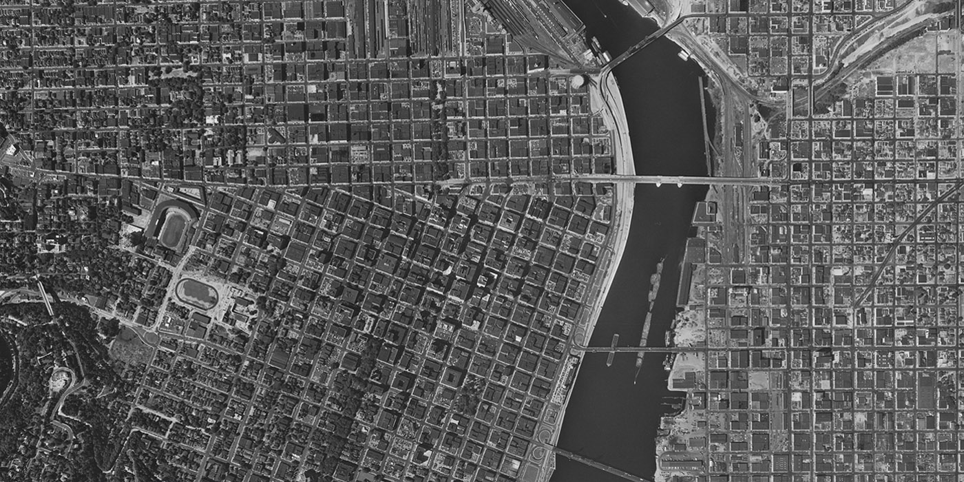
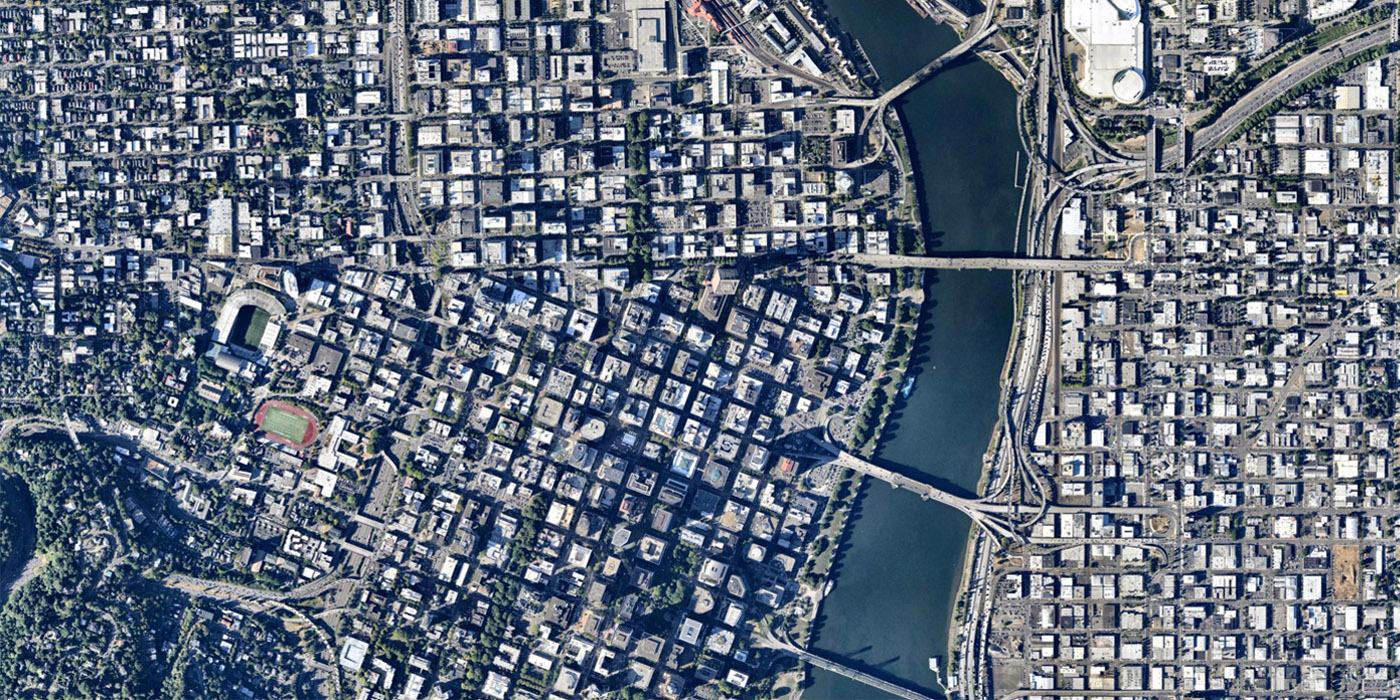
Portland, 1951 to 2014
Downtown Portland’s celebrated walkability is partially a function of its well-preserved grid of small, 200-foot blocks. Most of the street grid survived the construction of the sunken I-405. During the 50s and 60s, Harbor Drive was a limited access freeway along the west riverfront, but it became the first intentionally removed major highway in 1974, replaced with the riverfront park visible today.
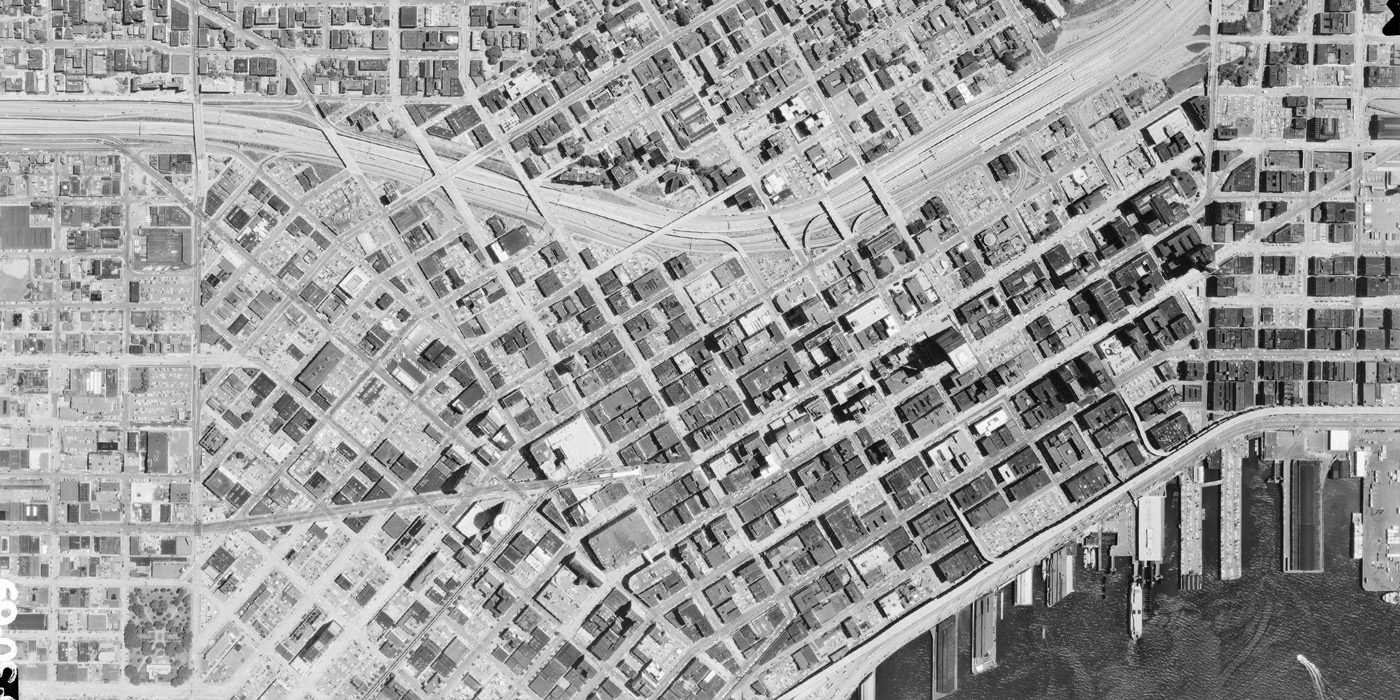
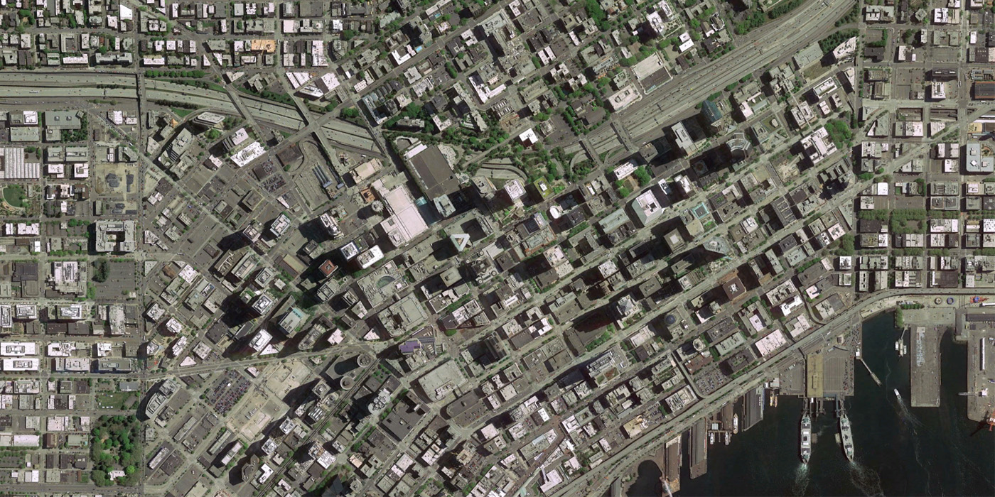
Seattle, 1969 to 2013
In this 1969 view of Seattle (north is oriented to the left), I-5 had only been open for two years. In the 1950s, residents of First Hill neighborhood protested the highway over fears of being cut off from the city and exposed to pollution, but the freeway was constructed anyway. Soon after the highway was finished, Freeway Park- the series of landscaped bridges that reconnect First Hill with downtown- was constructed. Project for Public Spaces recently helped revision the park.
Another contentious highway is the stacked Alaskan Way Viaduct along Seattle’s waterfront. Today, a multi-billion dollar project is attempting to reroute the Alaskan Way traffic into a tunnel and restore an urban waterfront. The tunnel project is moving again after a long hiatus due to a December 2013 breakdown of the boring machine “Bertha”, though Bertha is still encountering many obstacles.